Paris Boat Tour Map: Piers, Marinas and Routes
By Callum Hale · Updated · Affiliate links, explained in my disclosure
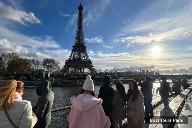
BATEAUX PARISIENS - S.E.V.P.T.E
Seine Cruise departing from the Eiffel Tower Web Rate
4.4 (92,539) · from $20
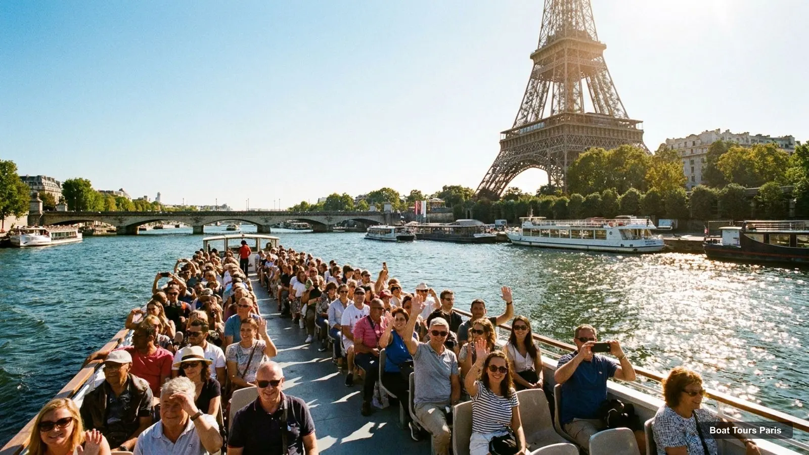
A Paris boat tour map is mostly a map of one stretch of the Seine: the Eiffel Tower piers, the Alma bridge dock, and a few boats further east and west. I pinned the boat companies, piers and waterfront sights from my Google Maps data, and the map links each pin to the tours that board there. If you are still choosing a cruise, my comparison of boat tours in Paris puts all 12 side by side.
Map data © OpenStreetMap contributors. Pins at Google Maps locations.
- Bateaux-Mouches · Boat company / departure · Google Maps
- Bateaux Parisiens · Boat company / departure · Google Maps
- Vedettes du Pont Neuf · Boat company / departure · Google Maps
- Vedettes de Paris · Boat company / departure · Google Maps
- Paris Seine · Boat company / departure · Google Maps
- Batobus París · Boat company / departure · Google Maps
- Batobus - Station Notre-Dame · Boat company / departure · Google Maps
- Boat in Paris - Private Boat Tour in Paris · Boat company / departure · Google Maps
- Green River Cruises · Boat company / departure · Google Maps
- Yachts de Paris · Boat company / departure · Google Maps
- My Boat Paris - Private Seine River Cruise Paris · Boat company / departure · Google Maps
- Batobus Station - Saint-Germain-des-Prés · Boat company / departure · Google Maps
- Port de l'Arsenal Garden · Pier or marina · Google Maps
- Paris Arsenal Port · Pier or marina · Google Maps
- Paris Yacht Marina · Pier or marina · Google Maps
- Paris Port · Pier or marina · Google Maps
- Bassin de l'Arsenal · Pier or marina · Google Maps
- Port du Gros Caillou · Pier or marina · Google Maps
- 17 Port Debilly · Pier or marina · Google Maps
- Port de la Bourdonnais · Pier or marina · Google Maps
- Eiffel Tower · Sight near the water · Google Maps
- Louvre Museum · Sight near the water · Google Maps
- Champ de Mars · Sight near the water · Google Maps
- Tuileries Garden · Sight near the water · Google Maps
- Notre-Dame Cathedral of Paris · Sight near the water · Google Maps
- Louvre Pyramid · Sight near the water · Google Maps
- Place de la Concorde · Sight near the water · Google Maps
- Place des Vosges · Sight near the water · Google Maps
- Place de la Bastille · Sight near the water · Google Maps
- Domaine National du Palais-Royal · Sight near the water · Google Maps
The Paris boat tour map covers every tour I compare, so use it to plan the walk from your hotel to the right dock. The Eiffel Tower piers and the Alma bridge dock are only 0.99 km apart in a straight line, which is why picking the wrong dock is the most common way to lose a boat.
How to Read the Paris Boat Tour Map
The pins on the Paris boat tour map fall into three groups. The boat companies (Bateaux Parisiens, Bateaux-Mouches, Vedettes de Paris, Batobus and a few smaller ones) are where you check in. The piers and quays, such as Port de la Bourdonnais, are the water landmarks. The waterfront sights, such as the Eiffel Tower, the Louvre and Notre-Dame, are what you see from the boat. Click a company pin on the Paris boat tour map and the map lists the tours from that operator.
One caution: several companies have more than one pin, because Google lists each ticket booth and dock separately, and Batobus has a pin for almost every stop. That is why I use the meeting point from the tour listing as the final word, and the Paris boat tour map as a guide to the area. If your ticket names a dock that is not on the map, trust the ticket.
Where Each Tour Leaves From
The table below is built from the listings. Where a listing says the meeting point depends on your option, I say that instead of guessing. Durations and prices are per person in US dollars.
| Tour | Where it leaves from | Duration | Price from |
|---|---|---|---|
| Seine Cruise departing from the Eiffel Tower | Port de la Bourdonnais, pontoon 3, foot of the Eiffel Tower | 1 hour | $20 |
| Evening River Cruise with Music | 2 Port de Suffren, near the Eiffel Tower, under the Vedettes de Paris flags | 1 hour | $28 |
| 3-Course Dinner Cruise with live music | Port de la Bourdonnais, pontoon 5 or 7 | 2.5 hours | $129 |
| Louvre Guided Tour with Reserved Access and Boat Cruise | Arc du Carrousel, in front of the Louvre pyramid, guide with a Mon Petit Paris sign | 1 day | $78 |
| Seine Cruise with Free Crepe | Port de la Bourdonnais, pontoon 3; crepe at Les Terrasses du Trocadero | 1 hour | $21 |
| Paris en Scene Dinner Cruise | 202 Port de Javel Haut, 75015 Paris | 105 minutes | $73 |
| Evening Lights Cruise with Bateaux-Mouches | Port de la Conference, Pont de l’Alma, 75008 Paris | 70 minutes to 1.5 hours | $19 |
| Hop-On Hop-Off Seine Cruise Pass | Any of 9 stops, from the Eiffel Tower (Port de la Bourdonnais) to Jardin des Plantes (Quai Saint-Bernard) | 24 or 48 hours | $26 |
| Bateaux-Mouches Sightseeing Cruise | Ramp by Pont de l’Alma, free parking 20 meters away | 1 hour | $19 |
| Bateaux-Mouches Dinner Cruise | Port de la Conference, restaurant hall near the Alma bridge, arrive 30 minutes early | 2.5 hours | $128 |
| 3-Course Gourmet Dinner Cruise | Port Solferino, foot of the Musee d’Orsay | 75 minutes to 2 hours | $98 |
| Seine River Bistronomic Dinner Cruise | Varies by option; check availability | 1.5 to 2 hours | $66 |
Bateaux Parisiens and Vedettes de Paris are almost neighbours: their docks are 0.22 km apart, and the Batobus Eiffel Tower stop is at the same quay. The Bateaux-Mouches dock is 0.99 km east, near Pont de l’Alma. Port Solferino, for the Extime dinner, is 2.29 km from the Eiffel Tower dock and 1.42 km from the Alma bridge. Paris en Scene sits west at Port de Javel Haut, 1.55 km from the Eiffel Tower pier.
Paris Seine Boat Tour Map
The Seine runs through the city from west to east here, so a Seine boat tour map reads left to right. On the west end is Port de Javel Haut, then the Eiffel Tower piers, then the Alma bridge, then Place de la Concorde and the Musee d’Orsay at Port Solferino, then the Louvre, the Pont des Arts and the Ile de la Cite with Notre-Dame. The Batobus line carries on east to the Jardin des Plantes.
Straight-line, the Eiffel Tower is 3.17 km from the Louvre and 4.1 km from Notre-Dame, which is why one hour on the water is enough to see them all. Most cruises go out and come back to the same dock, so you can leave your bags near the dock where you started. For a Paris cruise on the Seine with a route description, see my page on Paris Seine boat tours.
Paris Boat Tour Route
The route is the same for most tours. The one-hour Bateaux Parisiens listing names Les Invalides, the Musee d’Orsay, the Ile de la Cite, Notre-Dame, the Hotel de Ville, the Louvre, Place de la Concorde and the Grand Palais. The dinner boats add Pont Alexandre III and the Pont des Arts, and the Bateaux-Mouches listing names the Conciergerie and Ile Saint-Louis. Think of the Paris boat tour route as a short oval, upstream to the Ile de la Cite and back, not a one-way trip, apart from the Batobus pass, which is a line with 9 stops.
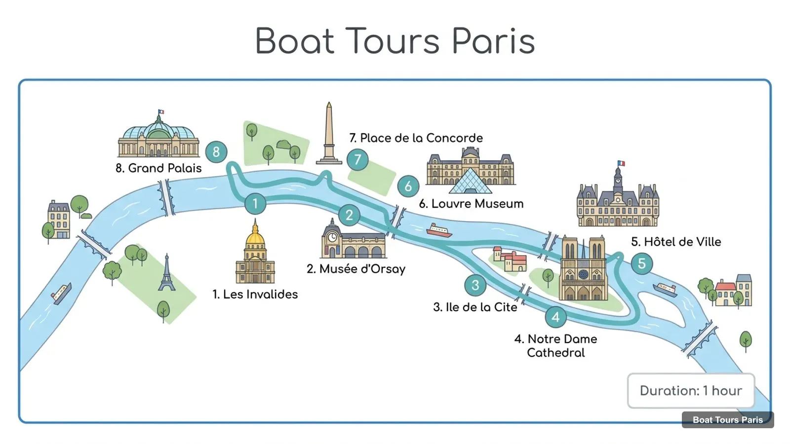
Stops on the route
- 1Les Invalides
- 2Musée d'Orsay
- 3Ile de la Cite
- 4Notre Dame Cathedral
- 5Hôtel de Ville
- 6Louvre Museum
- 7Place de la Concorde
- 8Grand Palais
Can You Take a Boat to Paris
The question people search is whether you can reach Paris by boat. The tours I compare are loops inside the city, not transport from another place, so none of them takes you to Paris from elsewhere, and none is a ferry or a commuter service. Within Paris, and on any Paris boat tour map, the Batobus is the only product in my data that works as transport: 9 stops, $26 for 24 or 48 hours. For the other 11 tours, the boat is the destination, and you return to where you started.
How to Tour Paris
How to tour Paris with the map: take the metro to the Eiffel Tower area, board a one-hour cruise, and walk back along the river. The Bateaux-Mouches listing says the dock is on metro line 9 (Alma-Marceau) or line 1. The Vedettes de Paris listing names metro line 9 to Trocadero among the closest stations and wheelchair access from the Bir-Hakeim bridge. I haven’t checked timetables, so look up the route on the Paris transport operator’s own site before you go.
For the sights near the docks, see the best things to do in Paris, which marks the ones you pass from the water.
Paris Boat Tour Private
Private boats are a separate market and not part of my tour comparison. Google Maps shows several small private-boat companies on the Paris boat tour map, such as My Paris River, Boat in Paris, Dolce Vita Yacht, Paris Boat Club and Yachts de Paris, and the directory below the hub page lists them with ratings. I have no prices or terms for them, so I don’t recommend one. For a group, check each company’s own page for capacity and price.
Where Is Tours in France Map
A common mix-up: Tours is also a city in France, far outside Paris, with no connection to these boat tours. The Paris boat tour map above is about boat tours in Paris only. If you were looking for the city, a general France map is what you need, and if you were looking for the river, this page is the right one.
Piers and Marinas
This list comes from my Google Maps data, with a link to each pin. The piers are where cruises board, and the basins and marinas are mostly where private boats are kept.
| Place | Address | Map |
|---|---|---|
| Port de la Bourdonnais | 75007 Paris, France | Google Maps |
| Port du Gros Caillou | Port de la Bourdonnais, 75007 Paris, France | Google Maps |
| Paris Canal - Port Solférino | en face du, 12 Port de Solférino, 23 Quai Valéry Giscard d’Estaing, 75007 Paris, France | Google Maps |
| Batobus - Station Notre-Dame | 21 Quai de Montebello, 75005 Paris, France | Google Maps |
| Batobus Station - Saint-Germain-des-Prés | 3 Quai Malaquais, 75006 Paris, France | Google Maps |
| île aux cygnes Pier | 8 Port de Grenelle, 75015 Paris, France | Google Maps |
| Paris Arsenal Port | 11 Bd de la Bastille, 75012 Paris, France | Google Maps |
| Bassin de l’Arsenal | Paris, France | Google Maps |
| Paris Port | 2 Quai de la Tournelle, 75005 Paris, France | Google Maps |
| Port de la Râpée | 75012 Paris, France | Google Maps |
| Halte nautique de la Villette | 64 Quai de la Seine, 75019 Paris, France | Google Maps |
| Square du Vert-Galant | 15 Pl. du Pont-Neuf-Christo et Jeanne-Claude, 75001 Paris, France | Google Maps |
For the full set of piers on one view, the Paris boat tour map at the top of this page pins all of them. For a meal on the water, my boat tours in Paris page covers the five dinner boats, and my Eiffel Tower and Louvre sights are ranked in the best things to do in Paris.
Tours I compared in Paris
My full review of each one, in the order I rank them:
- Seine Cruise departing from the Eiffel Tower Web Rate★ 4.4 · from $20
- Evening River Cruise with Music★ 4.4 · from $28
- 3-Course Dinner Cruise on the Seine with live music★ 4.7 · from $129
- Louvre Guided Tour with Reserved Access & Boat Cruise★ 4.3 · from $78
- Seine Cruise from the Eiffel Tower with Free Crepe★ 4.4 · from $21
- Paris en Scène - Seine River Panoramic Views Dinner Cruise★ 4.3 · from $73
- Evening Lights Cruise with Legendary Bateaux-Mouches®★ 4.4 · from $19
- Hop-On Hop-Off Seine Cruise Pass with 9 Stops★ 4.4 · from $26
- Bateaux Mouches® Sightseeing Cruise on the Seine★ 4.4 · from $19
- Bateaux Mouches® Dinner Cruise on the Seine River★ 4.5 · from $128
- 3-Course Gourmet Dinner Cruise on the Seine River★ 4.3 · from $98
- Seine River Bistronomic Dinner Cruise★ 4.2 · from $66