Boston Boat Tour Map: Piers, Marinas and Routes
By Callum Hale · Updated · Affiliate links, explained in my disclosure
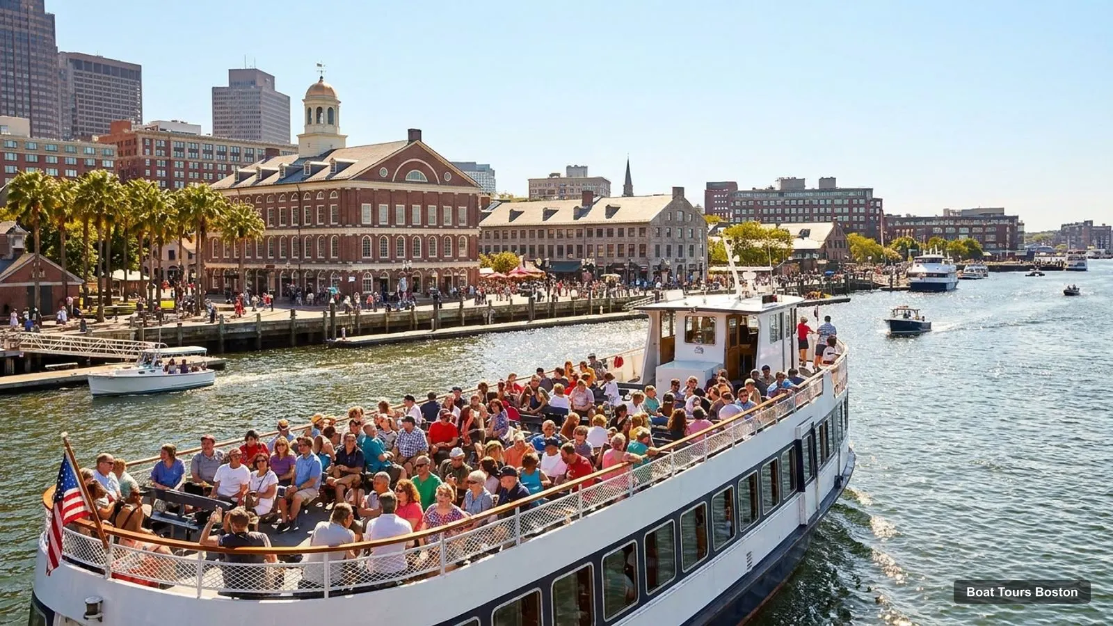
Boston Harbor City Cruises
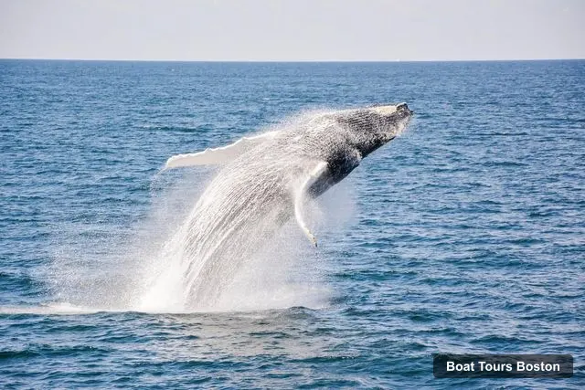
City Cruises Whale Watching Cruise
4.6 (5,463) · from $86
A Boston boat tour map is mostly a map of three wharves and a harbor: Long Wharf, Rowes Wharf and Commonwealth Pier, with Castle Island and the Charlestown Navy Yard at the two ends of the route. I pinned the boat companies, wharves, marinas and sights from my Google Maps data below, and each pin links to the matching tour when the company name matches. For the tours themselves, see my guide to boat tours in Boston.
Map data © OpenStreetMap contributors. Pins at Google Maps locations.
- Boston Harbor City Cruises · Boat company / departure · Google Maps
- Boston Duck Tours Prudential Center Departure Location · Boat company / departure · Google Maps
- Boston Duck Tours New England Aquarium Departure Location · Boat company / departure · Google Maps
- Boston Harbor City Cruises · Boat company / departure · Google Maps
- Classic Harbor Line Boston · Boat company / departure · Google Maps
- Charles River Boat Company · Boat company / departure · Google Maps
- Massachusetts Bay Lines · Boat company / departure · Google Maps
- Boston Electric Boats · Boat company / departure · Google Maps
- Liberty Fleet of Tall Ships Boston · Boat company / departure · Google Maps
- Cycleboat Boston · Boat company / departure · Google Maps
- Boston Harbor City Cruises · Boat company / departure · Google Maps
- Classic Sail Boston · Boat company / departure · Google Maps
- Long Wharf · Pier or marina · Google Maps
- Fan Pier Park · Pier or marina · Google Maps
- Constitution Marina · Pier or marina · Google Maps
- Boston Harborwalk · Pier or marina · Google Maps
- Harborwalk Lookout Terrace · Pier or marina · Google Maps
- Childrens Wharf Harborwalk · Pier or marina · Google Maps
- Observation Deck at Independence Wharf · Pier or marina · Google Maps
- Charlestown Marina · Pier or marina · Google Maps
- Faneuil Hall Marketplace · Sight near the water · Google Maps
- Boston Common · Sight near the water · Google Maps
- New England Aquarium · Sight near the water · Google Maps
- Museum of Science · Sight near the water · Google Maps
- Public Garden · Sight near the water · Google Maps
- Boston National Historical Park - Charlestown Navy Yard · Sight near the water · Google Maps
- Boston Tea Party Ships & Museum · Sight near the water · Google Maps
- Bunker Hill Monument · Sight near the water · Google Maps
- Boston Children's Museum · Sight near the water · Google Maps
- The Paul Revere House · Sight near the water · Google Maps
The Boston boat tour map covers every trip I compare, so use it to plan the walk from your hotel to the right wharf. Choosing the wrong one is the easiest way to miss a departure, which is why the table below says where each tour leaves from instead of guessing.
How to Read the Boston Boat Tour Map
The pins on the Boston boat tour map fall into three groups. Boat companies are where you check in, wharves and marinas are where the boats tie up, and sights are what you see from the water. Several companies have more than one pin because Google lists each ticket booth or office separately: Boston Harbor City Cruises has pins at Long Wharf, Rowes Wharf and the Seaport. Some operators, such as Charles River Boat Company, sit in Cambridge and are not part of any tour I compare. That is why I use the meeting point from the tour listing as the final word.
All distances on this page are straight lines between Google Maps coordinates. The Greenway, the Fort Point Channel and the Seaport streets make a short line a longer walk.
Where Each Tour Leaves From
Prices are per person in US dollars, checked on 11 November 2026, and every tour cancels free up to 24 hours before.
| Tour | Where it leaves from | Duration | Price from |
|---|---|---|---|
| Boston Harbor Sunset Cruise | Gate C at the ferry terminal behind the Boston Harbor Hotel, 60 Rowes Wharf | 1.5 hours | $31 |
| City Cruises Historical Sightseeing Cruise | One Long Wharf, between the Long Wharf Marriott and the New England Aquarium | 1 hour | $46 |
| Boston Harbor Cruise | Rowes Wharf, Ferry Terminal behind the Boston Harbor Hotel | 1.5 hours | $51 |
| Harbor Sunset Yacht Cruise | Rowes Wharf, Ferry Terminal behind the Boston Harbor Hotel | 2 hours | $54 |
| Downtown Harbor Sailing Cruise | Rowes Wharf, Ferry Terminal behind the Boston Harbor Hotel | 1.5 hours | $54 |
| City Cruises Sunset Skyline Cruise with Commentary | Long Wharf North, by the blue and white Boston Harbor City Cruises Ferry Center | 1.5 hours | $55 |
| City Cruises Harbor Codzilla High-Speed Thrill Boat | One Long Wharf, between the Long Wharf Marriott and the New England Aquarium | 45 minutes | $56 |
| City Cruises Boston: Harbor Buffet Lunch or Dinner Cruise | Commonwealth Pier, next to the World Trade Center, 200 Seaport Blvd | 2 - 3 hours | $81 |
| Harbor Champagne Sunset Sail from Rowes Wharf | Rowes Wharf, Ferry Terminal behind the Boston Harbor Hotel | 2 hours | $82 |
| City Cruises Whale Watching Cruise | One Long Wharf, between the Long Wharf Marriott and the New England Aquarium | 3.5 hours | $86 |
| Boston Harbor: Santa Brunch Cruise | Rowes Wharf, Ferry Terminal behind the Boston Harbor Hotel | 2 hours | $106 |
| City Cruises Boston: Premier Brunch or Dinner Harbor Cruise | Behind the Boston Harbor Hotel, 60 Rowes Wharf | 2 hours | $113 |
The whale watching trip is the only one that leaves the harbor for open water; its listing names the Gerry E. Studds Stellwagen Bank National Marine Sanctuary.
Sections of Boston Map for the Waterfront
Four stretches of waterfront on the Boston map matter to a boat passenger. Downtown, at Long Wharf and Rowes Wharf, is where 11 of the 12 tours start. The Seaport, at Commonwealth Pier, is where the Spirit of Boston boards; the Institute of Contemporary Art is 0.36 km from the pier. North of downtown are the North End, where Old North Church and the Paul Revere House are, and Charlestown, which has the Navy Yard and the Bunker Hill Monument. South of the Seaport is South Boston, where Castle Island sits.
If you are choosing a hotel from the Boston boat tour map, downtown is the natural base, and the best things to do in Boston page tells you which sights are a short walk from the wharves.
Where Is Southie in the Boston Map
Southie is South Boston, the neighbourhood across the Fort Point Channel from downtown. On a boat tour you see it from the water: the City Cruises historical and sunset trips name South Boston and Castle Island in their itineraries. Castle Island is 3.84 km from Long Wharf in a straight line, which is why it only appears on the longer routes. It is a state park with a rating of 4.7 from 6,494 Google reviews.
Ships to Visit in Boston
The ships most visitors want are the USS Constitution, which the harbor trips pass and which sits at the Charlestown Navy Yard 1.59 km from Long Wharf, and the USS Cassin Young, a destroyer that the Classic Harbor Line cruise names in its listing. If you want a ship you can board in the city, the Boston Tea Party Ships and Museum is 0.94 km from Long Wharf at 306 Congress St. The sailing trips use their own historic-style vessels, the schooners Adirondack III and IV.
Boston Boat Tour Map by Trip Type
The Boston boat tour map also shows which wharf suits which kind of trip. The history and speed trips start at Long Wharf: the one-hour historical cruise, the sunset skyline cruise, Codzilla and the whale watching boat. The yachts, the schooners and the dinner and brunch cruises start at Rowes Wharf, except the Spirit of Boston buffet in the Seaport. So if you know the type of trip you want, the map tells you the wharf, and the table tells you the exact meeting point.
Because Long Wharf and Rowes Wharf are only 0.5 km apart, you can walk between them in a few minutes. That makes it easy to compare two departures on the same afternoon if one sells out or the weather changes your mind.
Boston Map Pdf and Picture
People who search for a Boston map as a PDF or picture usually want something to print. I do not publish a printable file, because the pins on the Boston boat tour map above are live and link to the tours. A screenshot of the wharves and the table of meeting points works as an offline version: save the table, the three wharf names and the address of your boat’s check-in desk. Offline, in place of a Boston boat tour map, Long Wharf, Rowes Wharf and Commonwealth Pier are the three names to search for in any map app.
Piers and Marinas
On the Boston boat tour map these are the wharves, piers and marinas in my data that a visitor might use, with a link to each on Google Maps. Not every one is served by a tour I compare.
| Pier or marina | Address | Google rating |
|---|---|---|
| Long Wharf | 66 Long Wharf, Boston, MA 02110 | 4.7 from 1,559 reviews |
| Commonwealth Pier | Harborwalk, Boston, MA 02210 | 4.3 from 15 reviews |
| Boston Fish Pier | Boston, MA 02210 | 4.4 from 46 reviews |
| Fan Pier Marina | 10 Fan Pier Boulevard Mailbox #26, Boston, MA 02210 | 4.7 from 102 reviews |
| Boston Waterboat Marina | Custom House Block, 66 Long Wharf, Boston, MA 02110 | 4.7 from 82 reviews |
| The Marina at Rowes Wharf | 50 Rowes Wharf, Boston, MA 02110 | 4 from 22 reviews |
| India Wharf Marina | E India Row, Boston, MA 02110 | 4.6 from 26 reviews |
| Charlestown Marina | 1 Pier 8, 8 13th St, Charlestown, MA 02129 | 4.8 from 154 reviews |
| Constitution Marina | 28 Constitution Rd, Boston, MA 02129 | 4.6 from 374 reviews |
| EDIC Pier | Boston, MA 02210 | 4.4 from 51 reviews |
| Courthouse Docks | Boston, MA 02210 | 5 from 8 reviews |
| Boston Harborwalk | Boston Wharf Rd, Boston, MA 02210 | 4.8 from 371 reviews |
On the Boston boat tour map, Long Wharf and the Marina at Rowes Wharf are the two downtown departure points, 0.5 km apart. Commonwealth Pier is the Seaport departure. The marinas at Charlestown, Constitution, Fan Pier and India Wharf are private boating harbors and not departure points for the tours I compare.
How Far Is Boston from the Ocean
Boston Harbor opens to the Atlantic through the islands, and Boston Light, the lighthouse on Little Brewster Island, is 13.47 km from Long Wharf in a straight line. Most tours turn back well inside it. The whale watching cruise goes much farther, to Stellwagen Bank, which NOAA says is east of Boston between Cape Ann and Cape Cod. The National Park Service describes the Boston Harbor Islands as 34 islands and peninsulas within reach of downtown.
Boston Harbor Route Map
This part of the Boston boat tour map is a picture of the route: the infographic shows the route most harbor cruises follow, from the downtown wharves to the sights in the north and south of the harbor.
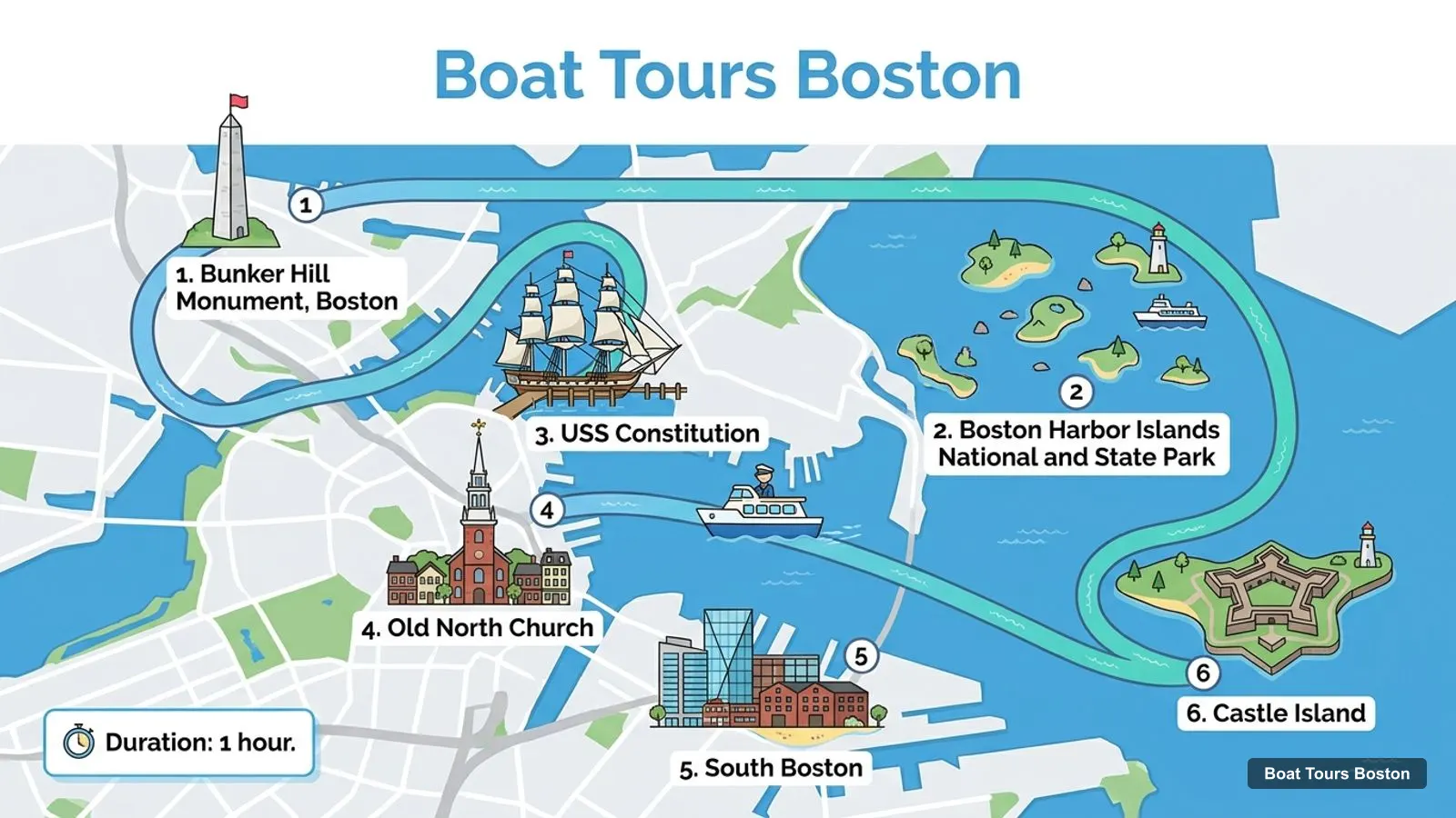
Stops on the route
- 1Bunker Hill Monument, Boston
- 2Boston Harbor Islands National and State Park
- 3USS Constitution
- 4Old North Church
- 5South Boston
- 6Castle Island
The listings name the same landmarks along the way: the USS Constitution, Charlestown Navy Yard, Bunker Hill Monument, Old North Church, Castle Island, the Boston Fish Pier and the Moakley Courthouse at Fan Pier. I cannot give a timetable for any tour, because the listings show departures only when you choose a date, and I did not find an official transit page I could cite for reaching the wharves, so I leave that out. If you want a sunset or an evening meal, my pages on the sunset cruise in Boston and the dinner cruise in Boston say which boats do it, and the full list is in my guide to every boat trip in Boston. More cities are on the Boat Tours Guide home page.
Frequently asked questions
Where do boat tours in Boston leave from?
Most leave from two wharves 0.5 km apart. City Cruises boats such as the historical cruise, whale watching and Codzilla board at One Long Wharf, and Classic Harbor Line, Mass Bay Lines and the Odyssey board at Rowes Wharf behind the Boston Harbor Hotel. The Spirit of Boston leaves from Commonwealth Pier in the Seaport.
Is there a map of the Boston boat tours?
Yes. The map near the top of this page pins the boat companies, wharves, marinas and sights from Google Maps, and the table below lists where each of the 12 tours leaves from, with its duration and price. Where the company name matches, a pin links to the matching tour on my site.
How far apart are the Boston wharves?
In a straight line Long Wharf and Rowes Wharf are 0.5 km apart, Rowes Wharf and Commonwealth Pier are 0.98 km apart, and Long Wharf to Commonwealth Pier is 1.27 km. Allow extra time for the walk, since the waterfront streets do not run in straight lines.
How far out do the Boston boats go?
Most sightseeing, sunset and sailing trips stay inside the harbor, passing the Charlestown Navy Yard, Castle Island and the harbor islands. Only the whale watching cruise goes to open water, to the Stellwagen Bank sanctuary. For scale, Boston Light on Little Brewster Island is 13.5 km from Long Wharf in a straight line.
Which Boston boat tour passes the most sights?
The City Cruises Historical Sightseeing Cruise names the most in its listing: the Bunker Hill Monument, the USS Constitution, Old North Church, South Boston, Castle Island and the Boston Harbor Islands. It costs $46 for 1 hour and has 4.6 stars from 1,995 reviews.
Tours I compared in Boston
My full review of each one, in the order I rank them:
- City Cruises Whale Watching Cruise★ 4.6 · from $86
- City Cruises Historical Sightseeing Cruise★ 4.6 · from $46
- Boston Harbor Sunset Cruise★ 4.4 · from $31
- Harbor Sunset Yacht Cruise★ 4.7 · from $54
- City Cruises Sunset Skyline Cruise with Commentary★ 4.6 · from $55
- Harbor Champagne Sunset Sail from Rowes Wharf★ 4.8 · from $82
- City Cruises Harbor Codzilla High-Speed Thrill Boat★ 4.6 · from $56
- City Cruises Boston: Harbor Buffet Lunch or Dinner Cruise★ 4.4 · from $81
- Downtown Harbor Sailing Cruise★ 4.8 · from $54
- Boston Harbor Cruise★ 4.6 · from $51
- City Cruises Boston: Premier Brunch or Dinner Harbor Cruise★ 4.3 · from $113
- Boston Harbor: Santa Brunch Cruise★ 4.8 · from $106